Subscribe for all my updates and don't miss a thing! Sign me up!
The Geography Of Jamaica
Its Structure, Atmosphere & Unique Features
Sharing Is Caring! Share this awesome content with your friends now.
The history and geography of Jamaica by C. Holness
The island of Jamaica has a diversely beautiful topography which is an awe-inspiring combination of beaches, mountains, rivers, waterfalls, plains, forests, bays, and caves.
New! Take a piece of Jamaica with you💃!
Savour the memories! Now you can get your authentic Jamaican souvenir items, as well as traditional Jamaican herbs, spices and housewares on our popular e-store. Click Here to learn more.
And, if you ever need a trustworthy and knowledgeable local guide, consider booking a private tour with us!
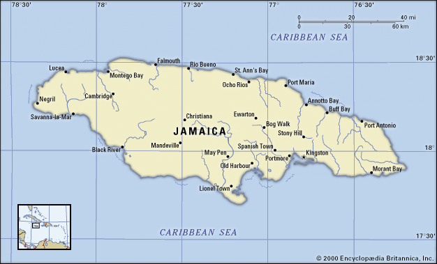
As the largest island of the Commonwealth Caribbean and the third-largest of the Greater Antilles, Jamaica boasts an area of 10,911 square kilometres which is filled with an endless bounty of natural wonders to explore and discover.
The Island is Formed
The land mass we now call Jamaica dates back to prehistoric times when it was formed by the deposits left by active undersea volcanoes.
These underwater layers of rock gradually developed overlying sheets of limestones on top of them, which remain to this day and are thousands of feet thick in some places.
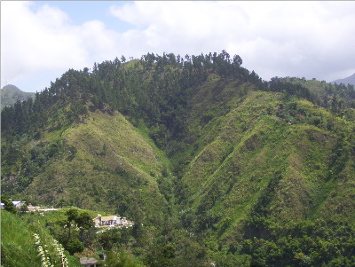
Jamaica is considered to have three main landform regions, they are: the coastal plains, central valleys, and eastern mountains.
Jamaica's Mountain Ranges
The Blue Mountain, Jamaica
The Blue Mountain
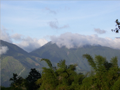
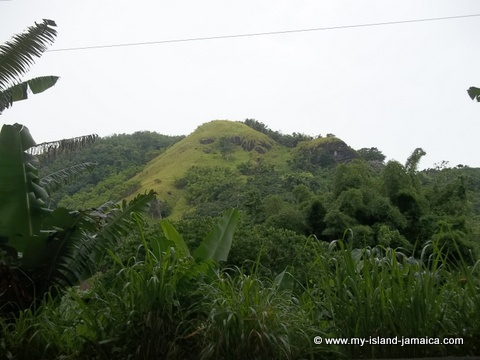
The Blue Mountains are Jamaica's most prominent and highest mountain range. Formed from an ancient uprising in the limestone, it's still possible to see the various layers throughout the underlying metamorphic rock in places.
Acting as a border between the eastern parishes of St. Thomas and Portland, these mountains extend from the northwest to southeast and are divided up into two separate ranges: the Port Royal Mountains which are just north of Kingston and the Central Range, in which the Blue Mountain Peak can be found, at a soaring height of just over 7400 feet, it is the highest point in the range.
Many visitors every year flock to these beautiful mountains for the terrific views they offer of the whole island, and to sample the famous Blue Mountain coffee which is grown there. They are also home to the fascinating Paplio Homerus, the second-largest butterly in the world.
John Crow Mountains
While the Blue Mountains may be the most famous mountain range in Jamaica, The John Crow Mountains are actually a larger range as they extend from just north of the Blue Mountain Range all the way to the island's northeast side.
Also formed from a slanted limestone plateau, this range boasts some high peaks as well, the steepest being 3300 feet.
The two most prominent areas of the John Crow range are the northerly Dry Harbour Mountains and the south's Manchester Plateau, the land between them is characterized by broken limestone layers interspersed with numerous streams that flow into them.
Back To Top Of Geography Of Jamaica
Caves and Sinkholes
Cockpit Country
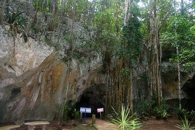
The landscape and physical geography of Jamaica is a dramatic example of a “karst” topography. Karst is a limestone terrain eroded in places to form such amazing features as caves, caverns, sinkholes, subterranean streams, and the characteristic reddish coloured soil called “terra rosa” .
The interior region known as "Cockpit Country" is characterized by a karst landscape and is mostly inhabited by the Maroon people who are descended from runaway slaves.
See also: Roaring River Caves & Attraction
Those who wish to explore this area in more detail can take the “Barbecue Bottom Road”, a scenic road alongside a valley that runs from north to south.
Jamaica's Coasts and Rivers
A diverse contrast of coastlines is found along the island's perimeter. Each coast has its own special qualities that give it unique, natural beauty. Generally it is rugged in most places, with inlets and plains interspersed throughout.
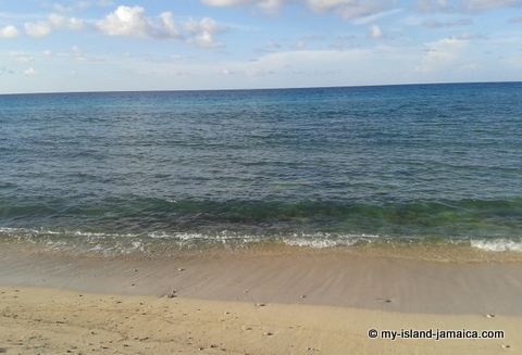
Along the northern coastline, you will find glorious white sand beaches and waters which are generally calm and are home to a coral reef, perfect for exploring on a dive.
The southern shores of the island have some black sand beaches, and by far the most popular beach areas are found along the western coast in places such as Negril.
The presence of many mountains across the island results in the formation of abundant waterfalls and rivers, of which there are 160 in total.
Jamaica's largest river is the Black River, and others which are of considerable size include the Rio Grande, White River, Rio Cobre, and the Lethe.
Climate in Jamaica
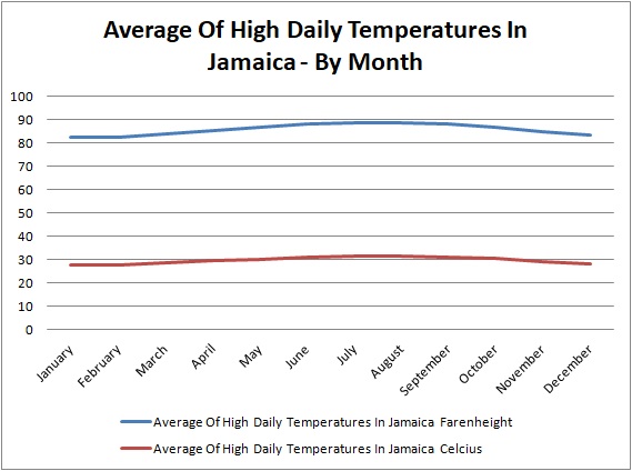
Jamaica is blessed with lovely, sunny weather year-round with constant temperatures in the average range of 25 to 30 °C in the most populated areas, and slightly lower temperatures in the mountainous regions.
The summer months typically are warmer than other seasons, but this slight difference is hardly noticeable since the island enjoys mild, pleasant weather throughout the year.
Jamaica has two different climates, which are divided by the mountains: on their windward side is an upland tropical climate, and on their leeward side is a semiarid climate.
Although most days are sunny, the island does see its fair share of rain, with the rainiest months being May and October.
The mountainous areas normally receive more rain than the low-lying regions, largely due to the action of the northeast Trade Winds.
Hot days are cooled down somewhat by the onshore breezes that blow onto the island's shores in the daytime, known as “Doctor Breeze”, while at night these breezes blow offshore, and are called the “Undertaker's Breeze”.
Hurricanes
Because of its location in the Atlantic hurricane belt, Jamaica is subject to being affected by hurricanes that form on the water and occasionally come up on land, bringing with them the potential to do considerable damage.
This rarely happens however, with the formation of hurricanes diminishing. The worst hurricanes to hit Jamaica would be Hurricane Charlie in 1951 and Hurricane Gilbert in 1988.
Agriculture and Vegetation
The island's rich soil is ideal for growing a wide variety of crops and nurturing many beautiful, exotic species of plants and flowers. Natural forests make up about twenty percent of the land.
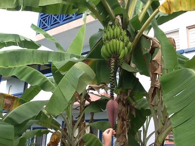
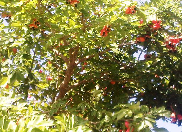
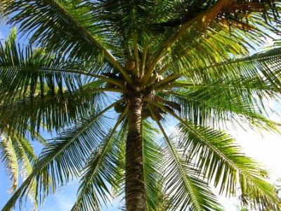
Jamaica is known for its sugar cane, mangoes, ackee, bananas, cocoa, ginger, limes, and coconuts to name a few, yet interestingly enough, none of them are indigenous to the island, instead they were originally brought from other continents, but have since continued to thrive here.
Coffee, grown predominately in the Blue Mountains is another major crop that is well-known and popular with locals and visitors alike.
Back To Top Of Geography Of Jamaica
Other Pages Related To Geography Of Jamaica
Return To Facts About Jamaica from Geography Of Jamaica
Return To HomePage from Geography Of Jamaica
External Reading: Geography of Jamaica (Wikipedia)
New! Get My Latest Book👇🏿
|
You asked, I've answered! You no longer need to save for months or years, to enjoy paradise! I spilled the beans! sharing my top tips on finding cozy accommodations and secret gems, only the way a native could! Click Here to pick it up on my e-store and start saving now! |
See The Best Of Jamaica - In Videos!
|
My channel reaches over 140,000 subscribers worldwide and has leveraged over 11 million views, sharing, what I call 'The Real Jamaica'. Subscribe today and join our family of viewers. |
Read More ...
New! Experience The REAL Jamaica!
Book Your Private Tour here and experience Jamaica the way we (locals) do!
P.S. Didn't find what you were looking for?
Still need help?
Click Here to try our dependable and effective Site Search tool. It works!
Or, simply click here and here, to browse my library of over 500 questions and answers! Chances are someone already asked (and got an answer to) your question.








New! Comments
Have your say about what you just read! Leave me a comment in the box below.